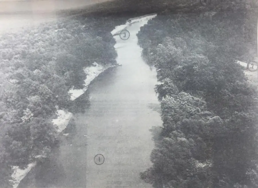
1963. Where the future Toledo Bend dam will rise! Plans called for the dam to rise 183 ft across the river at the point marked (1) above. Slightly above and to the left of this point, giant rocks may be seen in the stream. These boulders are part of a geologic fault which crosses the river and will soon provide a solid rock foundation for the great weight of the Earth filled dam. The aerial photo, looking downstream, shows Louisiana on the left and Texas on the right. Point (2) shows the farm to market road leaving from Burkeville to Toledo Bend. The mouth of Toro Bayou is at point (3) where this Louisiana stream empties into the Sabine River below the dam site. Hadden's Ferry, where the official groundbreaking ceremonies were held in October 1962, is located at point (4) on the photo. Information and photo from the Jan. 1, 1963 edition of The Longview News Journal
The original Facebook post
Where the future Toledo Bend dam will rise! Plans called for the dam to rise 183 ft across the river at the point marked (1) above. Slightly above and to the left of this point, giant rocks may be seen in the stream. These boulders are part of a geologic fault which crosses the river and will soon provide a solid rock foundation for the great weight of the Earth filled dam. The aerial photo, looking downstream, shows Louisiana on the left and Texas on the right. Point (2) shows the farm to market road leaving from Burkeville to Toledo Bend. The mouth of Toro Bayou is at point (3) where this Louisiana stream empties into the Sabine River below the dam site. Hadden's Ferry, where the official groundbreaking ceremonies were held in October 1962, is located at point (4) on the photo. Information and photo from the Jan. 1, 1963 edition of The Longview News Journal